File:Oregonocean.jpg: Difference between revisions
Jump to navigation
Jump to search
No edit summary |
No edit summary |
||
| Line 1: | Line 1: | ||
The [http://marinemap.org/faq Oregon Marine Map] is a Google Earth-based tool that allows users to draw prospective Marine Protected Areas and receive immediate feedback on the protections and impacts | |||
Latest revision as of 00:45, 15 April 2012
The Oregon Marine Map is a Google Earth-based tool that allows users to draw prospective Marine Protected Areas and receive immediate feedback on the protections and impacts
File history
Click on a date/time to view the file as it appeared at that time.
| Date/Time | Thumbnail | Dimensions | User | Comment | |
|---|---|---|---|---|---|
| current | 00:44, 15 April 2012 | 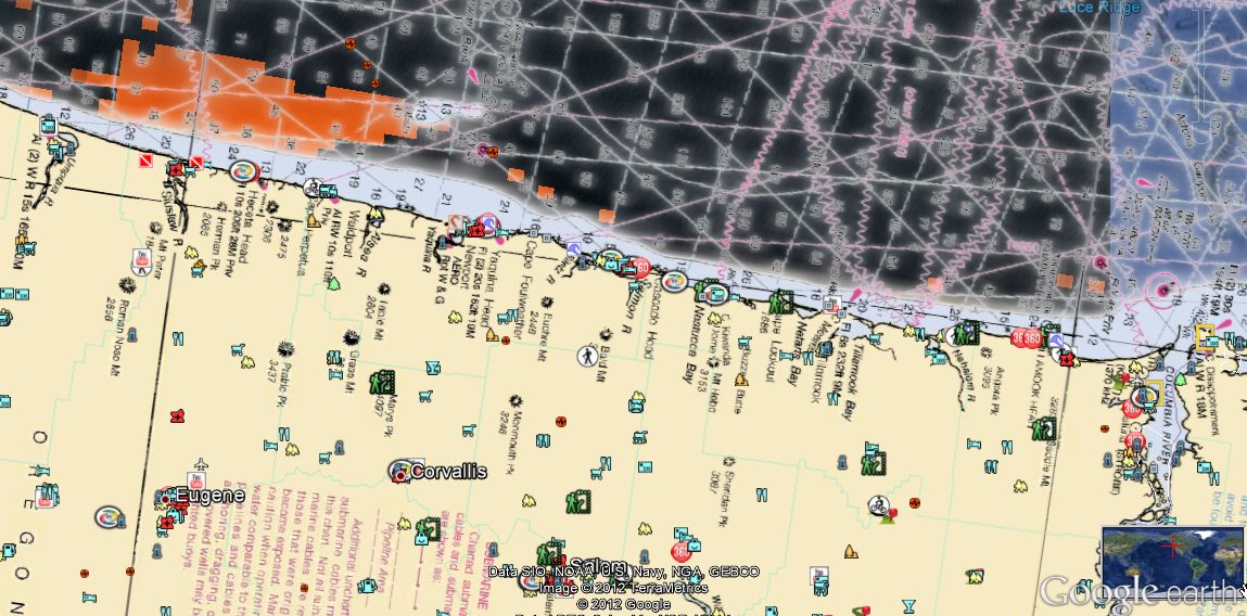 | 1,149 × 568 (153 KB) | Samc (talk | contribs) |
You cannot overwrite this file.
File usage
The following page uses this file: